Madmaheshwar Trek Route Map By Expert Trekker
If you are planning the Madmaheshwar Yatra and looking for a detailed Madmaheshwar trek route map, this guide is made exactly for you. Madmaheshwar is one of the five Panch Kedar temples of Uttarakhand and holds immense religious significance for Hindu devotees across India. The temple is dedicated to Lord Shiva and is located at an altitude of approximately 3,289 meters above sea level surrounded by some of the most breathtaking Himalayan peaks including the mighty Chaukhamba range. Every year thousands of pilgrims and trekkers undertake this beautiful and spiritually rewarding journey during the short summer season.
At DistanceData, Rohan and the team have created this complete guide with the full Madmaheshwar trek route map, day by day itinerary, weather conditions, vehicle details, packing list, permits, budget, and emergency contacts — everything you need in one place before you start your journey.
What is Madmaheshwar and Why is it Special?
One of the five sacred Panch Kedar temples where Lord Shiva’s navel is believed to have appeared.
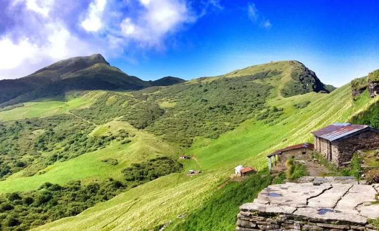
Madmaheshwar is one of the five Panch Kedar temples of Uttarakhand. According to Hindu mythology, after the Kurukshetra war the Pandavas sought the blessings of Lord Shiva who disguised himself as a bull and disappeared into the ground at different places. The navel of Lord Shiva is believed to have appeared at Madmaheshwar which is why this temple holds such deep religious importance. The temple sits in a stunning location surrounded by alpine meadows, dense forests, and massive Himalayan peaks. The view of the Chaukhamba, Kedarnath, and Neelkanth peaks from Madmaheshwar is absolutely unforgettable.
The Madmaheshwar trek route map starts from Rishikesh, passes through Ukhimath and Ransi Village before entering the forest trek route through Gaundar, Bantoli, and Khatara before finally reaching the sacred Madmaheshwar temple.
Madmaheshwar Trek Route Map – Full Distance and Altitude Table
Know every stop, distance, and altitude before you start your journey.
| Stop | Distance | Altitude | Mode |
|---|---|---|---|
| Rishikesh | Start | 356 m | Road |
| Ukhimath | 170 km | 1,311 m | Road |
| Ransi Village | 200 km | 1,800 m | Road – Trek Starts |
| Gaundar | 207 km | 2,100 m | Trek 6 to 7 km |
| Bantoli | 214 km | 2,450 m | Trek |
| Khatara | 218 km | 2,800 m | Trek |
| Madmaheshwar Temple | 222 km | 3,289 m | Trek Only |
5 Day Itinerary – Madmaheshwar Trek Route Map
A complete and practical 5 day plan covering the full Madmaheshwar yatra from Rishikesh and back.
Day 1 – Rishikesh to Ransi Village (200 km Drive)
The journey begins from Rishikesh which is the most convenient starting point for the Madmaheshwar trek route map. Most travelers reach Rishikesh by train or bus from Delhi or other major cities. Start very early from Rishikesh at around 5 AM because the drive to Ransi Village takes 7 to 9 hours and covers approximately 200 km on winding mountain roads. The route passes through Devprayag, Rudraprayag, and Ukhimath. Ukhimath is a very important religious town and is the winter seat of the Madmaheshwar deity. Stop at Ukhimath for lunch and visit the Ukhimath temple if time permits. Continue driving from Ukhimath to Ransi Village which is the base village where the trek officially begins. Reach Ransi by late afternoon, check in to a guesthouse, and rest well for the trek that starts tomorrow.
| Detail | Info |
|---|---|
| Distance | 200 km |
| Travel Mode | Car, Taxi, or Bus |
| Duration | 7 to 9 hours |
| Trek on This Day | None |
| Difficulty | Easy – long drive |
| Altitude Change | Rishikesh 356 m → Ransi 1,800 m |
| Lunch Stop | Ukhimath – visit temple if time permits |
| Scenery | Devprayag confluence, Rudraprayag, mountain valleys |
| Key Task | Stock up on cash and medicines at Ukhimath |
| Stay | Guesthouse at Ransi Village – Rs. 300 to Rs. 800 |
Day 2 – Ransi Village to Gaundar (6 to 7 km Trek)
This is the first real trekking day of the Madmaheshwar trek route map journey. Start the trek from Ransi Village early in the morning around 7 AM after a light breakfast. The trail begins through beautiful oak and rhododendron forests and gradually descends toward the Madmaheshwar River. The path crosses several suspension bridges over the river which is a highlight of this section. The trail is not very steep on this day which makes it a perfect warm up day for the more demanding trek ahead. Gaundar is a small settlement in a beautiful meadow setting beside the river and it serves as the campsite for the night.
| Detail | Info |
|---|---|
| Trek Distance | 6 to 7 km |
| Departure Time | 7:00 AM from Ransi |
| Trek Duration | 3 to 4 hours |
| Trek Difficulty | Easy to Moderate |
| Altitude Change | Ransi 1,800 m → Gaundar 2,100 m |
| Trail Type | Forest paths, descent to river, suspension bridges |
| Highlights | Suspension bridges, Madmaheshwar River views, dense forest |
| Scenery | Oak and rhododendron forests, river valley, mountain views |
| Key Task | Walk at a comfortable pace – save energy for Day 3 |
| Stay | Guesthouse or camp at Gaundar – Rs. 300 to Rs. 600 |
Day 3 – Gaundar to Madmaheshwar Temple via Bantoli and Khatara (10 to 12 km Trek)
This is the most important and most challenging day of the entire Madmaheshwar trek route map journey. Start very early from Gaundar at around 6 AM. The trail climbs steeply through dense forests and gradually opens up into beautiful alpine meadows as you gain altitude. Bantoli is a lovely spot at a river confluence where two streams meet and it is a perfect place for a short rest and snacks. Continue trekking through Khatara which is another small meadow campsite. Beyond Khatara the trail opens up completely and you enter the stunning high altitude alpine zone with panoramic views of Chaukhamba, Kedarnath, and Neelkanth peaks surrounding you on all sides. Finally reach the sacred Madmaheshwar temple and offer your prayers. The feeling of standing at the temple with those massive peaks all around you is beyond words.
| Detail | Info |
|---|---|
| Trek Distance | 10 to 12 km |
| Departure Time | 6:00 AM from Gaundar |
| Trek Duration | 6 to 7 hours |
| Trek Difficulty | Hard – steep ascent, high altitude |
| Altitude Change | Gaundar 2,100 m → Madmaheshwar 3,289 m |
| Trail Type | Steep forest ascent then open alpine meadows |
| Rest Stop 1 | Bantoli – river confluence, beautiful setting |
| Rest Stop 2 | Khatara – alpine meadow campsite |
| Highlights | Alpine meadows, Chaukhamba peak views, Madmaheshwar temple darshan |
| Scenery | Dense forests opening into stunning high altitude meadows and snow peaks |
| Key Task | Temple darshan and puja at Madmaheshwar |
| Stay | Guesthouse or camp at Madmaheshwar – Rs. 400 to Rs. 800 |
Day 4 – Madmaheshwar Darshan and Return to Gaundar (10 to 12 km Trek)
Wake up early on Day 4 for the morning aarti and darshan at Madmaheshwar temple. The morning view from the temple with the first golden light falling on the Chaukhamba peaks is one of the most divine and unforgettable sights you will ever witness in your life. Spend time in prayer and meditation at this sacred spot. After the morning darshan begin the return trek back to Gaundar following the same trail in reverse. The descent is easier on the lungs but harder on the knees so walk carefully especially on the steep sections. Reach Gaundar by late afternoon and rest for the final day tomorrow.
| Detail | Info |
|---|---|
| Trek Distance | 10 to 12 km descent |
| Departure Time | 8:00 AM after morning darshan |
| Trek Duration | 5 to 6 hours downhill |
| Trek Difficulty | Moderate – descent is easier but hard on knees |
| Altitude Change | Madmaheshwar 3,289 m → Gaundar 2,100 m |
| Morning Activity | Morning aarti and darshan at temple – 6:00 AM |
| Highlights | Sunrise on Chaukhamba peaks, morning temple aarti |
| Trail Type | Same alpine meadow and forest trail in reverse |
| Key Task | Descend slowly and carefully – protect your knees |
| Stay | Guesthouse or camp at Gaundar |
Day 5 – Gaundar to Ransi and Drive Back to Rishikesh (6 to 7 km Trek + 200 km Drive)
The final day of the Madmaheshwar trek route map journey begins with the last section of trekking from Gaundar back to Ransi Village. This descent takes about 2 to 3 hours and is relatively easy. Reach Ransi by mid morning, have a good meal, and then start the long drive back to Rishikesh. The return drive covers the same 200 km route through Ukhimath, Rudraprayag, and Devprayag and takes around 7 to 8 hours. Reach Rishikesh by evening carrying beautiful memories and the blessings of Lord Shiva from the sacred Madmaheshwar temple.
| Detail | Info |
|---|---|
| Trek Distance | 6 to 7 km downhill |
| Trek Duration | 2 to 3 hours |
| Trek Difficulty | Easy – comfortable descent |
| Drive Distance | 200 km – Ransi to Rishikesh |
| Drive Duration | 7 to 8 hours |
| Altitude Change | Gaundar 2,100 m → Ransi 1,800 m → Rishikesh 356 m |
| Departure from Ransi | By 10:00 AM to reach Rishikesh before dark |
| Scenery | Forest trail, river views, mountain valleys on drive |
| Key Task | Start early from Gaundar to reach Rishikesh before night |
| Stay | Departure from Rishikesh or overnight at Rishikesh |
Vehicle Guide for Madmaheshwar Trek Route
Know exactly which vehicle to use for each section of the journey.
| Stretch | Vehicle | Road Condition |
|---|---|---|
| Rishikesh to Devprayag | Bus or Taxi | Good Highway |
| Devprayag to Rudraprayag | Taxi or Bus | Mountain Road |
| Rudraprayag to Ukhimath | Taxi | Narrow Mountain Road |
| Ukhimath to Ransi | Taxi or Local Vehicle | Very Narrow Rough Road |
| Ransi to Gaundar | Trek Only | Forest Trail – No Road |
| Gaundar to Madmaheshwar | Trek Only | Mountain Trail – No Road |
Weather and Best Time to Visit
Plan your trip in the right season to avoid route closures and dangerous conditions.
| Month | Temp at Madmaheshwar | Condition | Should You Go? |
|---|---|---|---|
| Jan – Apr | -5°C to 5°C | Route Closed, Snow | No |
| May | 8°C to 18°C | Route Opens | Good |
| June | 10°C to 20°C | Best Weather | Best Time |
| July | 8°C to 17°C | Monsoon Rain | Avoid |
| August | 8°C to 16°C | Heavy Rain, Slippery | Avoid |
| September | 6°C to 15°C | Clear Skies | Very Good |
| October | 2°C to 10°C | Cold but Clear | Good |
| November+ | Below 0°C | Route Closes | No |
Permits Required
Registration is mandatory before starting the Madmaheshwar trek.
| Permit | Where to Get | Documents Needed |
|---|---|---|
| Trek Registration | Forest Office at Ransi | Aadhaar Card |
| Medical Fitness Certificate | Any registered doctor | For senior travelers |
Packing List
Packing right can make the difference between a safe trek and a dangerous one.
| Item | Importance |
|---|---|
| Warm Jacket and Thermals | Must Have |
| Waterproof Trekking Shoes | Must Have |
| Rain Poncho | Must Have |
| Sleeping Bag | Must Have |
| Trekking Poles | Must Have |
| Sunscreen SPF 50 and Sunglasses | Must Have |
| Headlamp and Power Bank | Must Have |
| First Aid Kit and Medicines | Must Have |
| Water Bottle | Must Have |
| Sufficient Cash | Must Have |
| Aadhaar Card | Must Have |
| Dry Snacks and Energy Bars | Recommended |
| Warm Gloves and Woolen Cap | Must Have |
Total Budget Table
Plan your complete expenses for the Madmaheshwar yatra.
| Expense | Cost Per Person |
|---|---|
| Rishikesh to Ransi Taxi | Rs. 2,000 to Rs. 4,000 |
| Accommodation 5 Days | Rs. 1,500 to Rs. 4,000 |
| Food Entire Trip | Rs. 1,500 to Rs. 3,000 |
| Trek Registration | Rs. 150 to Rs. 300 |
| Porter or Guide Optional | Rs. 500 to Rs. 700 per day |
| Miscellaneous | Rs. 500 to Rs. 1,000 |
| Total Budget | Rs. 6,000 to Rs. 13,000 |
Accommodation on the Route
Simple but comfortable stays available at every major stop.
| Location | Options | Cost Per Night |
|---|---|---|
| Rishikesh | Hotels | Rs. 500 to Rs. 2,500 |
| Ukhimath | Guesthouses | Rs. 400 to Rs. 1,000 |
| Ransi Village | Guesthouses | Rs. 300 to Rs. 800 |
| Gaundar | Guesthouses and Camps | Rs. 300 to Rs. 600 |
| Madmaheshwar | Guesthouses and Camps | Rs. 400 to Rs. 800 |
Altitude Sickness Tips
Madmaheshwar sits at 3,289 meters so take altitude seriously.
The Madmaheshwar temple sits at 3,289 meters which is high enough to cause altitude sickness in unprepared travelers. Never rush the acclimatization process and always rest properly at Gaundar before proceeding to Madmaheshwar. Drink at least 3 to 4 liters of water every day and avoid alcohol completely during the trek. Walk slowly at all times even when you feel fine. If you experience severe headache, nausea, or difficulty breathing descend to a lower altitude immediately. People with heart conditions, blood pressure issues, or breathing problems must consult a doctor before attempting this trek.
Nearby Places to Visit
Do not miss these beautiful places near the Madmaheshwar route.
| Place | Distance | Highlight |
|---|---|---|
| Ukhimath Temple | At Ukhimath | Winter seat of Madmaheshwar deity |
| Kedarnath | 65 km from Ukhimath | Most sacred Panch Kedar temple |
| Tungnath | 45 km from Ukhimath | Highest Shiva temple in the world |
| Deoria Tal | 13 km from Ukhimath | Stunning reflection lake |
| Chopta | 40 km from Ukhimath | Mini Switzerland of Uttarakhand |
Emergency Contact Numbers
Save these numbers before you leave for the Madmaheshwar yatra.
| Service | Number |
|---|---|
| Uttarakhand Tourism Helpline | 1364 (For other state: +91- 135- 1364) |
| National Emergency | 112 |
| Ambulance | 108 |
Final Thoughts
The Madmaheshwar trek route map is a journey that beautifully combines deep spiritual devotion with stunning natural beauty. From the sacred rivers of Rishikesh to the ancient temple at 3,289 meters surrounded by some of the most magnificent peaks in the Himalayas, every step of this yatra is filled with meaning and beauty. Whether you are a devoted pilgrim seeking the blessings of Lord Shiva or an adventure trekker looking for an off the beaten path Himalayan experience, Madmaheshwar will leave a deep impression on your heart and soul.
At DistanceData, Rohan and the team are committed to giving every traveler the most accurate, helpful, and trustworthy travel information so that your sacred journey is safe, well planned, and truly memorable. Plan well, walk slowly, respect the mountains and the local culture, and carry the blessings of Lord Shiva home with you.
All information is researched and verified. Always confirm latest route and weather conditions with local Uttarakhand authorities before starting your yatra.